
I spent the Fourth of July holiday week traveling on much of the Oregon Backcountry Discovery Route, which is a (mostly) offroad route that runs from the California border to the Washington border.
Being that I live about an hour from Mt. Hood, I travelled the route from north to south, which is just fine, too. Though the route is designed with dual-sport and adventure bikes in mind, all the trails that I ran from Mt. Hood to Bend had been cleared (we get a lot of downed trees from wind and snow over the winter) wide enough for Jeeps. The non-profit organization has GPS tracks that you can download from their website and, after running the route, I am definitely putting them on my annual donation list. Having traveled extensively in the Oregon Coast Range mountains, I can say that the time saved in not have to cut downed trees or having to backtrack due to a closed road, is invaluable.
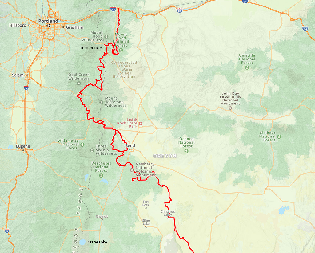
The route actually begins (if running north to south) in Hood River but due to time constraints and a forest fire on the Washington side of Hood River (making for some nasty air quality), I picked-up the trail at Government Camp and made my way to Trillium Lake, which is not on the route but as you can see, is not to be missed. This was right around 6AM and there were already some ripples on the water from the breeze, but I am still happy with the shot!
From the Trillium Lake snowpark, I headed on up Highway 26 to the Clear Lake turnoff and headed down a series of heavily-cratered Forest Service roads (i.e. not fun) to the first gravel/dirt track, just south of Timothy Lake.
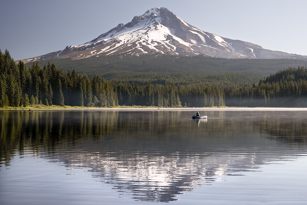
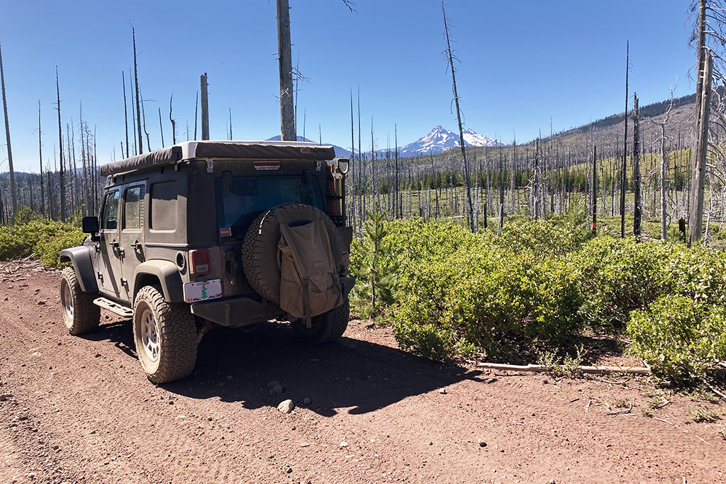
This route from Timothy Lake to Summit Lake is absolutely wonderful! It is very tight in sections (that is a 3-foot diameter tree that had been cleared, in the background) but just a relaxing cruise through big timber. I will definitely be back to run this section for a little picnic at Summit Lake. Here is a 3-minute clip of the roads between Timothy Lake and Summit Lake:
Unfortunately, Summit Lake is about the end of the fun for a while as you pick up a series of mainline (dusty!) gravel roads out to the Clackamas River and then on to the town of Detroit. From Detroit it is back up into the timber on typical Forest Service roads, but a nice respite from the dust, until you get to Big Lake which is also the Santiam Pass OHV Recreation Area. Buckle up!
This section has it all, soft-silty sand and short sections of small (though serious enough!) rock crawling. 4L is a must in some areas, just to crawl slow enough to pick your line through the rocks. I suspect this is one area where the JKU’s 2.72:1 transfer case shines over the Rubicon’s 4.00:1 because I spent a lot of time in 4th and 5th gear (I have 4.88:1 ring & pinion gearing). It’s not hardcore rock crawling, but you definitely need to know where your differential is so that you do not smack it on a rock, and you need time to pick the right line. Unfortunately, I did not get any pictures of the fun sections (I was busy!) but just be prepared for some actual “wheeling” when you get there.
Once you are out of the OHV area, it’s back to dusty gravel roads – although now the dust is red volcanic rock. It is smooth sailing into the town of Sisters, where you can gas-up and provision-up at the grocery store. If you forgot to pack bug spray, you will definitely remember to get some here, because the mosquitoes are plentiful over this entire route. I do not know how the dual-sport bike guys do it, because I had to deploy the screen room on my ARB awning every night.
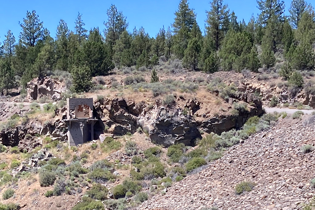
Unfortunately, one of the main Forest Service roads out of Sisters was closed for maintenance during my trip, so the BDR organization had an alternate route to Bend which went through the Tumalo Natural Area. It is mundane paved and gravel roads, but I had never been through this area before, so it was actually very interesting. One highlight was the ill-fated 1915 Tumalo Dam, where the gatehouse is still standing. For history buffs, the dam was supposed to bring irrigated agriculture to the Bend area, but the porous volcanic rock that encompasses the entire area would not hold the water. The land drank the water as fast as the dam could collect it, and it was a bust. To witness the reverse in action, though, take a side excursion to Blue Pool between Detroit and the Santiam Pass OHV Recreation Area. Blue Pool is fed by underground springs through the porous rock and is 37-degrees all year-around. Which brings us to Crater Lake.
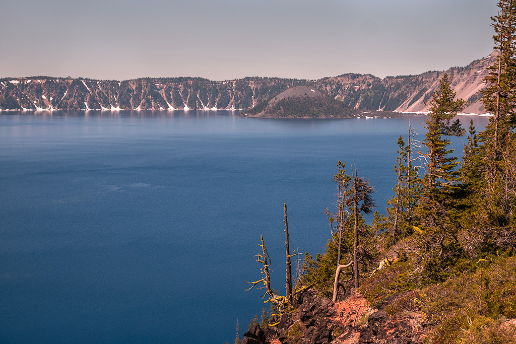
Crater Lake was my destination on this trip, so I dropped-off the Oregon Backcountry Discovery Route, in Bend. The ORBDR heads east out of Bend, to the Hart Mountain National Antelope Refuge. With my sights set on Crater Lake, though, I spent the night south of Bend, several miles off of South Century Drive in the Deschutes National Forest. From there, it was an easy drive on Forest Service roads down to Diamond Lake, and then a quick jaunt across Highway 138 to the north entrance to Crater Lake. This is one of those places like Yosemite or Yellowstone, that you do not want to be trying to enter after about 9:00 AM, so get there early or get in line behind many other vehicles (probably 50 cars and motorcycles when I exited at 11:00 AM – and that was much less popular north entrance). Like Lassen Volcanic National Park east of Redding, CA, Crater Lake is just barely open in early July due to the huge amount of snow that these parks receive over the winter. I have been through Lassen on the Fourth of July and the road opened that very morning. Crater Lake was open on this Fourth of July, but not the entire loop around the lake. There was still lots of work to do, to repair the roadway and remove debris from the winter. Heavy machinery was everywhere, and I am sure that if this was not a holiday there would have been additional closures on the loop, when the crews were working.
I had a great time on the ORBDR, but now the Jeep and all of my gear needs a thorough cleaning! I met some great people along the way, both on bikes and 4×4’s – including one Jeep just like mine, driven by Dan from San Diego. What are the odds of that happening?